Wildfire Fight Continues

Aug 14, 2018 | 6:12 AM

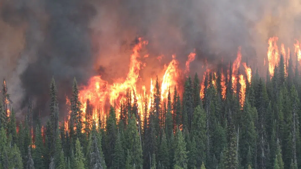
PRINCE GEORGE – There is some good news to the south where BC Wildfire fire crews report the Narcosli Creek fire is 50 percent contained. It’s currently burning at 3,400 hectares. In addition, the BC Wildfire Service says guards have now been built around 90 percent of the fire.  However, an evacuation alert remains in place for West Quesnel. 

The Shag Creek fire, north of Itcha Ilgachuz Park, is currently burning at 8,410 hectares. Due to safety reasons, there are no resources currently on this fire. An Evacuation Order has been implemented by the Cariboo Regional District for properties in the area. 

The Blackwater River fire, located 72 kilometres west of Quesnel, is about 4,500 hectares in size. There is 17 firefighters, six pieces of heavy equipment and one helicopter on site. Ground crews worked on establishing a guard on the east side Monday. There is an Evacuation Alert in place and the Order has been expanded by the CRD. 

The evacuation alert impacting 57 properties for the Houseman Road area has been lifted. It’s located about 25 kilometres northeast of 100 Mile House. 

For more information on alerts and orders in the Cariboo Regional District, visit their website. Residents are strongly encouraged to register for the Cariboo Chilcotin Emergency Notification System to receive a text, call or email regarding Evacuation Alerts and Orders

Regional District of Bulkley-Nechako

Meantime residents near Fort St. James are being urged to prepare for evacuation as fires are getting closer to that community. An expanded evacuation order from the Regional District of Bulkley Nechako now reaches to the northern shores of Fraser Lake and east to the perimeter of the Nadleh Whuten First Nation. 

Preparations for a possible evacuation are also underway in Vanderhoof.  Although the community is not under an order or an alert, Mayor Gerry Thiessen says it is working on a plan. The BC Wildfire Service says black ash is falling in the Vanderhoof area in central B.C. due to a 315 square-kilometre blaze roughly 90 kilometres west of the municipality and from increased winds blowing from the west.

The Shovel Lake Fire is considered to be over 508 square kilometres. There is no rain in the forecast for the area around the fire. 

An expanded evacuation order and alert remain are in effect for the area surrounding the Island Lake fire. Alerts include one for the Village of Fraser Lake. The fire is currently at about 13,000 hectares in size. The expanded order is for Binto Wo Forest Service Road (FSR) to 400 metres east of Nithi Road, Nithi Pit Road and a portion of Holy Cross Binta FSR. South of Francois Lake to above the Binta Main FSR including Francois Lake Provincial Park. The expanded alert is for the area from South of Highway 16 to North of Knapp Lake.  From East of Tercer Lake FSR and Uncha and Binta Lakes to West of Lily Lake Road and the Holy Cross FSR.

About 60 kilometres south of Houston, the Nadina Lake wildfire is at about 25,000 hectares in size. BC Wildfire says the blaze continues to make things difficult for crews and. They add that there is little information being reported at this time. An expanded Evacuation Order and Alert have been issued due to this fire.

For the Verdun wildfire, an expanded evacuation order is in effect for the Tatalaska FSR south to Ootsa Lake; Keefe’s Landing Road, including Hewson Lake, the west end of Ootsanee Lake and to the middle of Cheslatta Lake, Nechako Reservoir. The blaze is at about 4,500 hectares, while crews build and maintain guards around homes in the area. The ferry is running 24/7 should it be needed.

The Purvis Lake fire is currently at about 1,457 hectares with 15 percent of it contained. An expanded evacuation order is in effect for the area including Purvis Lake to Tchentlo Lake and the Tchentlo Forest Service Road (FSR), south of Nation Lakes Park to the intersection of the Leo Creek FSR and the Driftwood FSR. This order does not include the Driftwood Forest Service Road (FSR). 

The Chutanli Lake fire is at about 9,800 hectares in size, located 11 kilometres northeast of Tatelkuz Lake. The Kluskus FSR is closed from the 70KM to the 113KM. The Martin Road and the Blue Road have also been closed due to fire activity. An evacuation alert remains in effect for South of Bobtail Connector Forest Service Road (FSR), from Red Road to Tatuk Lake FSR, and South to the Regional District of Bulkley-Nechako Boundary.

About 24 kilometres south of Fort Babine, the Torkelsen Lake fire is 880 hectares. It’s 65 percent guarded and 15 percent contained with a revised expanded evacuation order in place. Crews will continue working to prevent impacts to transmission lines, cabins and property. Currently, the Nilkitkwa Forest Service Road and access to Fort Babine have not been impacted by the fire. Firefighting resources and flaggers may be seen on the road near the 18-kilometre marker.

Earlier this week, a Declaration of State of Local Emergency was ordered by the Regional District of Bulkley-Nechako. A state of local emergency exists in the regional district due to the wildfires and risk to people and property. 

For further information on evacuation alerts and orders, visit the Bulkey-Nechako Regional District’s website or call the RD at 250-692-3195. 

Prince George Evacuation Centre

Meantime the Evacuation Centre in Prince George continues to accept affected residents from the northwest and the south.  More than 150 evacuees have registered in the City.

Updates regarding the areas affected by wildfires can be found on the BC Wildfire Service’s Twitter and Facebook pages. 


Click here to report an error or typo in this article