Giant Map at UNBC
Adults to kids at UNBC

Two gripping interactive displays at UNBC

May 24, 2019 | 4:32 PM

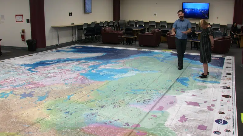
PRINCE GEORGE – There are two displays on at the UNBC library these days that are causing a stir. One is a giant map that occupies the floor, outlining all the First Nations in Canada, their languages and their connections to each other.

For the creator of the map, Chris Brackley of As the Crown Flies Cartography, it was a learning experience.

“As I got into be able to show the individual First Nations, the 634 that’s right across our nation, to know there were that many, to see how they connected with the land through treaty and reserve and to see that pattern as it existed is always a thrill for a cartographer to see.”

Right beside the giant map in the library is another eye-popper. It is called an augmented reality sandbox and the coolest sandbox in town. With the help of a projector, the topography of the sand is determined. By building different “hills” and “rivers” in the sand, the program creates rivers and snow-covered mountains. From there, the water flow is determined, all through topography. The program was created for educational purposes but it has practical applications as well.

“There are some very practical community-based applications for it that go beyond the educational aspects of it,” explains Johanna Pfalz of eclipse Geomatics. “Using the tool for, possibly, some land use scenarios, different development options, particularly as they relate to hydrology or snow pack.”

And both projects are looking to get into classrooms.

Click here to report an error or typo in this article