CKPG File Image
FLOODING

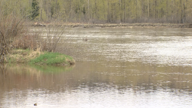
Delayed snow pack melt creating elevated risk for flooding in Prince George and surrounding areas

May 11, 2022 | 5:44 PM

PRINCE GEORGE – The cooler weather seen throughout the spring has put out the talk of any wildfire danger for Prince George and the area, although the potential of flooding has only worsened.

April was one of the top five coldest on record for Prince George in total nearly 5 degrees below average. Examples of recent years with colder than normal April temperatures are 2008 and 2011.

“I would say it was a pretty dramatic shift, the flood risk has increased considerably,” said Johnathan Boyd, a Hydrologist with the BC River Forecast Centre. “In particular, Prince George and the Upper Fraser is an area that is at risk.”

According to the latest report from the BC River Forecast Centre, the snowpack levels reflect the abnormal weather. Delayed snowmelt has led to concerns about a possible worst-case scenario if some precipitation fell and was followed by a heat dome-type event instead of a gradual warming of temperatures.

Boyd said the Robson Valley could be another area in danger of flooding if temperatures warm up higher than normal for more than five days at a time, in turn triggering a mass melt from higher elevations into the valley bottom.

The snowpack for the Robson Valley included in the Upper Fraser East region along with the McGregor Mountain Range sits at 125% of normal for May 1st.

The snowpack for areas like Vanderhoof and Fort St. James sits among the highest in the province at 143% of normal for May 1st.

Despite high numbers, experts don’t believe it’s a guarantee that we will see river breaching their banks across the region.

“We have had years where we had around 200% of the normal than usual snowpack for the Nechako West and it didn’t necessarily cause a lot of flooding,” said Dr. Stephen Dery, Professor in the Environmental Science department at UNBC. ” It can vary from year-to-year, it’s not unusual that we are above or below average but certainly we have to keep an eye on it.”

The average of all snow measurements across B.C. increased to 113% over the past month (April 1st was 99%)

The combination of high snow pack in the Upper Fraser East, Quesnel and North Thompson indicates a heightened concern for flooding for Prince George, Kamloops, and the overall Fraser River.

Based solely on the contributions to the Fraser River from the Upper Fraser East, Quesnel and North Thompson, this year ranks as the 2nd highest risk in the last 45 years.

There is a risk that an extreme heat wave in late May or early June could create peak flows reminiscent of 1948 or 1972 for the lower Fraser River.

Back in 1972, Downtown Prince George was consumed by water with the Nechako River backing up onto First Avenue. Since then a dyke has been constructed on River Road, and flood protection has been added on the CN Rail tracks adjacent.

Click here to report an error or typo in this article