Atmospheric rivers deluge parts of B.C. as storm season begins

Sep 25, 2024 | 11:42 AM

A series of atmospheric rivers has been moving across British Columbia’s north and central coasts and spreading into the Interior.

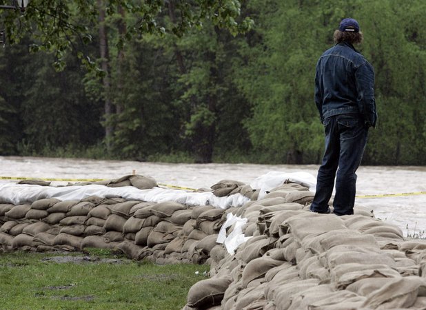
The River Forecast Centre has issued high-stream flow advisories and several flood watches throughout the province, as well as one higher-level flood warning for the Telkwa River in northwestern B.C.

The centre says the river east of Terrace peaked Tuesday, registering flow levels between a 20- and 50-year return period, while most other coastal rivers had been peaking at levels typically seen every one to five years.

The forecaster says moderate to heavy rain had started spreading across the Interior, where a flood watch is in effect for the North Thompson region, including tributaries around Clearwater.

Wednesday’s bulletin says no major flooding is expected in the Interior, but heavy rainfall could worsen runoff from areas scorched by wildfire.

Lower-level streamflow advisories cover the Cariboo region, including headwaters of the Quesnel River, as well as the South Thompson, Upper Fraser and Upper Columbia rivers and their surrounding areas.

Environment Canada has meanwhile issued a series of wind warnings and special weather statements throughout much of the province.

The weather office says many areas in the southern Interior and southeast are expected to see strong winds and heavy downpours through Wednesday night.

Another bulletin says an intense low pressure system — the remnants of Typhoon Pulasan — will also bring strong winds to the coast on Thursday.

It says winds are expected to reach speeds of 90 km/h with gusts up to 120 km/h on exposed coastal sections of northern Vancouver Island, Haida Gwaii and the central coast.

This report by The Canadian Press was first published Sept. 25, 2024.

The Canadian Press

Click here to report an error or typo in this article