high flow season

High snowpack and warm temperatures mix for higher than usual river flow

May 25, 2020 | 2:39 PM

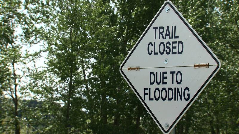
PRINCE GEORGE – The effects of higher than usual snowpack is beginning to be seen in areas of Prince George.

In areas such as Cottonwood Island Park, visitors may notice some higher than usual river levels for this time fo year.

David Campbell from the BC River Forecast Centre states that the East Fraser Basin is the key contributing factor based on their latest Snow Basin Index.

“We’re definitely seeing in the May 15th Snow Survey, and we have seen leading up to now, that the snowpack in the area has been high within the Upper Fraser East Basin, which is within the Robson Valley region. May 15th was 133 per cent of normal.”

This time last year, the Upper Fraser East Basin was at 77 per cent of normal.

According to Campbell, we’re now finding ourselves knee-deep in the high flow season. In fact, for the Fraser River flowing through Prince George, river flow is at 150 per cent of normal which is unusual this early in the year, with forecasting showing we could be experiencing high flow levels for the next few weeks.

“Certainly with the rivers high, there’s less capacity to absorb any other runoff that comes from the snowmelt or rainfall. Maybe the next two to three, maybe even four weeks, is that critical window where we are very sensitive to any kind of weather pattern that will accelerate the snowmelt (hot weather, heavy rain) that will add to the initial runoff. I do think these next few weeks are critical.”

The River Forecast Centre is closely monitoring what’s coming in the next week having referenced a potential of a high-pressure ridge coming through, however that has since shifted further east.

That being said, Campbell does say there is still potential that Prince George could get into that flood stage if temperatures reach above seasonal.

Click here to report an error or typo in this article